- South-easterly trade winds reach exposed parts of the east, south-east and south first, but terrain creates important local exceptions.
- The west is more often leeward, yet west does not mean windless: a headland, mountain or gap can completely change the airflow.
- In Le Morne, choose between exact zones, times and activities rather than labelling the whole peninsula windy or calm.
Open a Mauritius forecast before your trip and the island can look neatly divided into a windy half and a calm half. On the ground, that map quickly falls apart. Water may be almost glassy around one bend while, a few kilometres away, the trade wind is already roughening the lagoon and filling kites above the reef.
The short answer is that south-easterly trade winds are generally felt first on exposed parts of the east, south-east and south, while the west is more often leeward. Mauritius is mountainous, however. Ridges, valleys, headlands and isolated peaks redirect and accelerate air, so the exact beach matters more than the single word east or west.
The short answer: read wind and terrain together
The Government of Mauritius says south-easterly trade winds blow for most of the year and are steadier from May to October. Environmental studies describe a windward zone across the south and south-east and a more sheltered leeward zone to the west. That is a useful starting point, not a beach forecast.
Terrain can overturn the average picture. In the official Mauritius Meteorological Services climate tables, the August mean wind speed at the representative western station of Médine is 17.1 km/h. The equivalent value is 15.2 km/h at Plaisance in the south, 13.3 km/h at Pamplemousses in the north and 11.7 km/h at Fuel in the east. These are weather stations rather than a beach ranking, but they show why a compass arrow alone cannot choose your coast.
Mauritius coasts at a glance
| Area | Typical pattern | What it suits |
|---|---|---|
| East and south-east | More direct exposure to the trade wind; winter can feel breezier, cloudier and showery. | Active days and fresh air; for swimming, choose a protected lagoon and check current conditions. |
| South | Exposed headlands and ocean-facing sections may feel rougher than neighbouring lagoons. | Dramatic scenery and walks; water activities need a carefully chosen operator and location. |
| West and north-west | More often sheltered by the central mountains, although local wind acceleration still occurs. | Beach time and sunsets; do not assume every western beach will be windless. |
| Le Morne | The mountain and peninsula create several different wind zones within a small area. | A sheltered beach and an active kite-lagoon day can coexist when conditions line up. |
This table explains the usual logic, not a promise. A cold front, strong anticyclone, local shower or unusual direction can rewrite the day. Before going on the water, check direction, gusts, sea state, warnings and tide as well as average speed.
When Mauritius gets more wind
Mauritius Meteorological Services describes a warm, humid summer from November to April and a relatively cool, dry winter from June to September, with May and October as transition months. Trade winds do not switch on at midnight on the first day of a season. A good windy day can arrive in summer, and the wind can pause for hours during a winter trip.
It is more useful to plan with windows. If you want calm beach time, leave room to change coast or time of day. If your trip is built around a wind sport, keep several possible days instead of pinning everything on one session. A season improves the odds; it does not turn a climate average into an hourly forecast.
Check the current bulletin and special warnings with Mauritius Meteorological Services. An attractive wind number in an app cannot replace what is happening on the beach, especially when a mountain or headland sits between the model grid and the lagoon.
Why Le Morne breaks the simple map
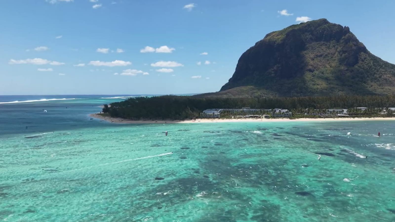
Le Morne sits in the south-west, an area that often looks sheltered on a broad island map. The massif rises almost from the water and changes how the south-easterly flow reaches the peninsula. One side can feel quieter while, by the kite lagoon, wind wraps around the mountain and arrives at a useful angle. A short move along the shore can produce a different day without changing where you stay.
That is why “Le Morne is windy” is not enough information. Swimmers need the exact shore section, current and sea state. Kitesurfers must also consider direction, gusts, tide, clear space and rider level. Our Le Morne spots and wind guide separates the learning lagoon, Manawa, Small Reef and One Eye because they serve different skills and cannot be swapped casually.
What public Google Maps feedback adds
Public reviews help describe how a place feels, but they are not a wind forecast or a safety assessment. Around Kite Lagoon, feedback is spread across several nearby school and access-point listings rather than one neutral lagoon page. Recurring observations include the scenery, shallow or sheltered learning areas and easy water access; visitors also note that low tide can change the usable depth substantially.
One Eye has a dedicated spot listing. Reviewers repeatedly praise the clear water, dramatic setting and quality of the waves, while some also mention strong wind or current and busy periods. That combination reinforces the practical distinction: a spectacular place to watch is not automatically a suitable place for a beginner to ride or swim.
For Manawa, we could not verify a reliable standalone Google Maps review page under that exact name at the time of checking; search results mix broader Le Morne spots with nearby operators. The absence of a review card is not evidence that conditions are easy. Use the spot guide, current forecast and a local briefing instead.
The same mountain that makes the backdrop memorable can create disturbed wind in the wrong place. Independent riders should not launch simply because other kites are visible. First understand the zone limits, the return route and what lies downwind.
Choose the coast for the day you want
For swimming and a slow beach day, look for a protected lagoon rather than the abstract idea of “the west”. Arrive early, walk the shore and compare the water surface across more than one section. For a hike or island drive, a moderate breeze may make a warm day more comfortable; rain and trail conditions matter more.
Couples and families can split the day without crossing Mauritius. One person can choose a wind activity while the rest of the group uses a calmer part of the beach or meets later for lunch. Le Morne works well for that plan, but proximity does not erase zoning: a swimming area and kite launch should never merge through convenience.
If the forecast is borderline, do not build the day around proving it wrong. Keep a main plan and a fallback. On a calm day, choose the beach, permitted snorkelling or a south-west road trip. When the wind fits, move the centre of the day to the lagoon.
When wind becomes part of the holiday
For someone with no experience, kitesurfing does not begin with buying equipment or trying to hold a full-size kite on the beach. An instructor first reads the area and explains the safety system, then teaches you to manage power. The best learning day is not the one with the highest wind number; it combines steady direction, safe space, suitable tide and the right kite size.
If you want to understand the sport without being promised a two-hour miracle, read what happens in a first Le Morne lesson. Then compare the Kitebelles lesson formats and message the team with your dates, approximate weight, water confidence and accommodation area. We will look at the precise forecast, suggest a realistic window or tell you when a different plan makes more sense.
Sources and checks: Government of Mauritius — climate and trade winds; Mauritius Meteorological Services — island climate; MMS regional tables for the west, north, east and south. Climate values, links and wording were checked on 22 August 2026; entering the water always requires a current daily forecast. Public Google Maps listings and review patterns for Kite Lagoon, One Eye and Manawa were checked on the same date; comments are paraphrased, while changing ratings and review counts are deliberately not reproduced.
Frequently asked questions
South-easterly trade winds generally expose the east, south-east and parts of the south first, while the west is more often leeward. Mountains, headlands and gaps create important local exceptions, so the exact beach and daily forecast matter more than a simple east-versus-west rule.
The south-easterly trade winds blow for much of the year and are generally steadier from May to October. A season is not a booking guarantee: strength, direction, rain and sea state still change from day to day.
No. The west is generally more sheltered from the prevailing trade winds, but local terrain can accelerate or redirect airflow. Le Morne is the clearest example: very different wind can be felt around the same mountain and peninsula.
Not necessarily. The peninsula has exposed and sheltered sections, and conditions change with wind direction and time of day. Choose the exact beach for your plan rather than judging all of Le Morne from one forecast icon.
Yes, when the day’s wind, tide and water traffic suit a lesson. Beginners should start with an instructor and learn the safety system and kite control before focusing on the board.